© Debbie Priestly / SeeMorzine.com


Morzine Snow Report : 28th December 2012
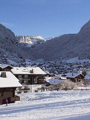
A soggy week in Morzine
Christmas was a great day here is Les Portes du Soleil, we had may not have had sunshine, but we did have great snow, and the visibility wasn’t all that bad either. For everyone who made it out of bed, and up the mountain, there was some great skiing to be had!
Boxing day was even better; with the sun poking it’s head through the clouds for most of the day. The snow was a little on the hard side in places, but it softened up nicely in the sunshine and warmer temperatures.
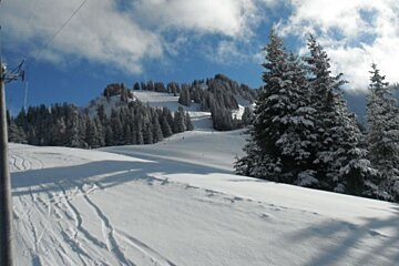
Today on the other hand, was not the best day to be up the hill. Rain at resort level made getting to the slopes a rather wet experience. If you didn’t have a waterproof jacket you would probably have been soaked in Morzine just getting to the lifts, where as slightly higher in Avoriaz you would have been walking through a snow storm. This made for some interesting skiing conditions, and when the wind picked up later, especially if you were wet, it got real cold real fast. I’ll admit we got off the slopes real quick when it got windy, as I was completely soaked by about half one.
The weather forecast is for it to get colder tonight, and the snow to turn to rain as far down as eight hundred meters. Tomorrow should be a nicer day completely. There is light snow forecast in the morning, with virtually no wind, and sunshine and light wind (fifteen kilometers per hour at the top) forecast for the afternoon. The temperatures are due to be cooler, but nothing too extreme, with the minimum temperature forecast, including wind chill, at the top set to be minus twenty three, but that’s over night. It will get close to that on Sunday afternoon so do wrap up warm if you’re heading out on the mountain.
Saturday should be fairly sunny, with light cloud cover coming in in the afternoon. It’s forecast to snow overnight and into Sunday morning, clearing overnight with clear skied on Monday morning. The cloud cover is set to make a return on Monday afternoon, with snow moving in for Tuesday, along with some moderate twenty kilometers per hour wind speeds over night. Apart from that the wind speed is fairly moderate and the temperatures are, as usual, coldest over night.
After the wind and rain today, the off-piste conditions are going to be a little dangerous. Today was a risk three in most areas, but the risk is very likely to be going up tomorrow. Watch out for wind slabs high up and wet snow slides lower down.
For the end of this week, I’d recommend making the most of the sunshine and fresh snow. The higher slopes should have most of the snow, but even down low there should be a little fresh snow. Tomorrow morning should involve skiing in light snowfall, so remember to wrap up warm and wear a scarf or something similar to keep the snow off your skin. The light may be a little flat with the falling snow, but should improve as the afternoon progresses, so take care in the morning, you don’t want to finish your holiday not being able to ski on the last day!
It is going to be very busy next, with a lot of people coming to celebrate New Year in the Alps. The pistes are going to be busy, so you may want to head out of the main Les Portes du Soleil ski areas to find the quieter slopes. If you have a full Les Portes du Soleil ski pass, why not explore as far afield as St-Jean d’Aulps, Mon Cherie, near Les Gets, or head over to the Swiss side if you’re feeling a little more adventurous!
Next week brings the New Year, and at the moment, some new snow, which will be very welcome. If you’re out for the New Year, check out our Apres ski reports and events calendar for ideas on what to see and where to go to make the most of your time off the hill. Avoriaz always has a spectacular fireworks display for New Year, which is well worth seeing, and Morzine is the place to be if you want to see the year out in a party.
See you in the snow!
Stats
-
Alt. Resort: 1000m
-
Alt. Summit: 2466m
-
High Temp.: Nord
-
Alt. High Temp.: 1000m
-
Latest Conditions: TODAY - WEDNESDAY JANUARY 02 2013 Improving - morning cloud - partly cloudy and cold with a fairly strong NE wind later SKY CONDITION : early in the morning, clear above 3500 m although mostly cloudy, then cloudy, below - becoming cloudy with sunny spells, then partly cloudy in the afternoon. Period of sunshine close to 50%.