


Morzine Snow Report: 7th March 2013
Sticky days before the snow
This morning it was raining and warm in Les Portes du Soleil, but with temperatures set to drop, things are looking up for the ski area. There’s even a little snow on the forecast!
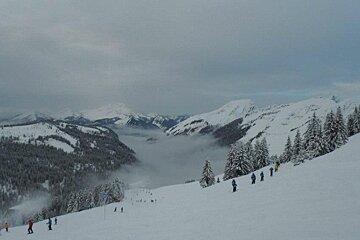
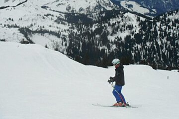
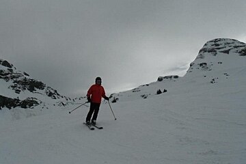
Conditions have been getting rather sticky lately with slushy snow on pretty much all of the slopes. If you have ventures into any of the snow parks, you’ll probably find riding boxes is pretty difficult right now - in fact you'll actually stick to the boxes at the moment! It’s a little scary if you’re going fast which is something to watch out for - you feel like someone has slammed the brakes on and you can get shot out of the front of your skis or do a nice face-plant on a board. In addition, the mogul fields low down as you come into resort are now a mix of snow and mud in the troughs, so if you do enjoy bumps, pick the higher up fields. By the end of the day, water skis might be more appropriate than the more geographically traditional snow version!
Safe to say, I’m glad it’s getting colder!
The forecast is for a gradual decrease in temperatures from today and the freezing level should get down to about 500m on Tuesday night. Over the next few days we should see a bit of a mix of everything. Friday should be cloudy with light snow and mild wind forecast and temperatures around -3 (-8 with wind chill) at the top and getting as warm as 6 degrees in Morzine town.
Saturday should see some clouds and sunshine in the morning followed by more sunshine and some snow showers in the afternoon. Temperatures will be similar to Friday but with higher winds in the afternoon of around 20 kmph at the top. Sunday should see the return of the sunshine but cooler temperatures without the cloud cover to keep the heat in around -9, wind chill included, at the top.
The snow should be back on Monday with showers in the morning, and light snow in the afternoon. The temperature is set to drop again in the afternoon to around -12 with windchill. Snow showers should continue through the night and in to Tuesday morning. It should be cooler again with the snow continuing into a very cold night. This will make for icy conditions on and off the slopes, so be careful if you’re skiing, and even more careful if you are driving round the Alps.
We’re now moving towards the last week of half term holidays, (I can’t wait to get back to tranquil pistes!) but the slopes are still busy. The biggest problem I noticed today was in slope awareness though. Please don’t be the skier who skis right across the slope in front of everyone without a second thought.
There is a FIS (Federation International du Ski) code for a reason, and one of it’s golden rules is being aware of where you are and other people on the slope. Apart from that, and the rain, it was quite fun riding today though. The soft snow made for some variable conditions that kept you on your toes and the lack of visibility meant you had to think with your feet. These flat light days really separate the good skiers from the pack, so do yourself a favor and stick to gentler slopes if you are feeling a little nervous. Skiing is no fun when you’re terrified and there are plenty of lovely blue and green slopes around this ski area. It’s one of the best ski areas for beginners in the Alps!
With conditions looking very variable over the next few days keeping warm will be very important. It’s amazing how much colder you feel as soon as the sun drops behind a cloud. If you are considering lunch on the hill, head to the restaurants either earlier or later than standard lunch time and avoid the worst of the queues.
Enjoy the warmer conditions, and remember to wrap up well on Tuesday and Wednesday next week. Being cold really ruins your day!
Bon ski!
Stats
-
Alt. Resort: 1800m
-
Alt. Summit: 2466m
-
High Temp.: -4
-
Alt. High Temp.: 1800m