© G. Towler

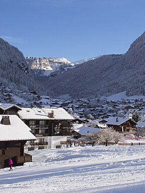
Change comes to Morzine after a sunny week
After a week of sunshine, things could be about to change
It’s been another week of springtime conditions throughout the Portes du Soleil with yet more warm temperatures and sunshine.
The past week began with warm temperatures, although the temperature did drop somewhat on Tuesday. The temperature drop meant that conditions temporarily went from slushy to hard packed even icy pistes which came as something of a surprise to locals who had got used to the slushy snow. Normal service was resumed by Wednesday, however, as the temperatures went up once again.
The warm weather has continued for the past few days, although the temperature has once again begun to drop. This is good news, as precipitation is forecast for the next couple of days, particularly Tuesday afternoon/evening going into Wednesday and Thursday, and it would be far more beneficial to the overall conditions if it fell as snow rather than rain. At the moment, it looks as though there is likely to be some rain at least in Morzine but, hopefully, there will be more fresh snow higher up. The best chance for snow in town is throughout the day on Thursday.

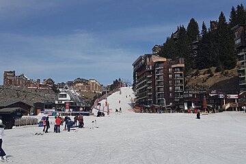
Morzine is beginning to look far more summery, with large parts of the mountains becoming more and more green as the days go by. However, the snow cover on the pistes themselves is still very good and the continued warm weather is no cause for concern. Some of the lower pistes, in particular on the Pleney, are now completely surrounded by grass but the snow has been moved onto the pistes and there are not any major issues with snow cover around Morzine and Les Gets. The only slight problem now is that the run down to the bottom of Mont Chery has been closed due to a lack of snow and skiers have to get the lift down. The snow on the pistes above the lift, however, is still very good. The back of Mont Chery is relatively shaded so has some of the best snow cover in that area.

On Super Morzine, the sides of the pistes are also looking quite patchy now but the snow cover on the pistes is still good. It could certainly do with a bit of a top up and, hopefully, the forecast snow will be enough to keep conditions relatively good for the last couple of weeks of the season. Those looking for the best snow cover should head high, particularly up around the Arare and Fornet areas. The avalanche risk is at one out of five, which is understandable considering the lack of snow off-piste.

At the moment, up to 50cm of snow is forecast for the upper slopes over the next few days. The issue that will define how the next week goes is the freezing level. The current forecast is predicting that the freezing level will initially be at around 1800m before dropping to around 1300m by Wednesday. This would mean snow on almost all the slopes in the area. By Thursday, it is expected to drop even further though, with snow forecast at town level.

The expected snowfall could be amongst the last significant snowfalls of the winter, so it is advisable to take advantage and enjoy it. The pistes at the moment are very quiet so there are no crowds to worry about. Anyone who has booked to come out for the end of the season could have some great conditions to look forward to.