© Giles Towler

Snow forecast for Morzine after sunny spell
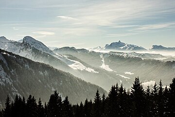
Change is in the air in the Portes du Soleil
It’s been another week of warm sunny weather in Morzine and Les Gets, but things are starting to change in town.
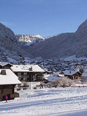
The temperatures have been up at around 15C for the past fortnight, with warm and slushy conditions. However, it looks as though winter is already returning.

The weather started to cool somewhat on Thursday, although the sun was still shining. Friday has been grey and overcast all day, and rain has been falling in Morzine. However, snow has been falling on the higher slopes, providing a much needed top-up. The temperature looks set to drop even further, and snow should begin falling on Morzine within the next couple of days. At the moment, the freezing level is at around 1100m, meaning that almost all the slopes except the very lowest sections will be getting snowed on, rather than rained on.

For the past week, however, the slopes have been slushy with some brown patches starting to show through. It has been an unusually long period of warm weather for this time of year, bringing to mind late season conditions when it gets warm enough to go skiing in a T-shirt. The downside of the beautiful weather has been that the snow has become increasingly slow, although with some icy patches in the shade. This can lead to suddenly speeding up, then abruptly slowing down as you ski into the shade and then out of it again. The pistes have been becoming increasingly filled with large slushy moguls.
It has been another busy week as the school holidays continue. The final week of European holidays is just about to begin, however, and hopefully the coming week will see quieter conditions. From the end of next week however, the slopes should quieten down significantly. For the past week, as with the previous week, it’s been a good idea to head up a bit later in the day when the crowds head off for lunch. The forecast at the moment is for snow throughout the coming week. There may be more rain coming to town, but there should still be snow on the pistes. The freezing level remaining just above town has the benefit of making it easier to get around.

For the past week, due to the warm temperatures, the best snow conditions have been on the higher slopes around Fornet and Arare. The lower slopes, in particular those that get the most sun throughout the day, have suffered the most due to the warm weather. On the plus side though, there is still a good base for the most part, throughout the resort. There is currently a base of between 130cm at 1800m. and 225cm on the highest slopes at 2400m.
Whilst the past couple of weeks might have felt as though winter was drawing to a premature end, there is still almost two months still to go, and at the moment it looks as though things are going to improve considerably. It might come as something of a shock to people who have enjoyed skiing in hoodies for the past couple of weeks, but it looks as though there is going to be a serious amount of snowfall over the coming days, and anyone coming out in the next couple of weeks who has been looking anxiously at the webcams should be more than happy with the amount of snow forecast.