© valerievictoor | Instagram
Snow report 8 February 2024
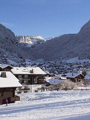
It’s been a mild and mostly sunny week here for the last quiet week on the slopes before the half term crowds arrive. Luckily with the crowds comes the colder weather and it looks like there is snow in the forecast.
Oh my goodness we have a turbulent week of weather coming up. It’s all changing right now, the sunshine has been replaced by cloudier skies and the temperature is dropping although the freezing level is still going to be an issue for the lower slopes. Light rain due tonight, this will be snow over 2300 metres.
We have a north/south divide in the weather and the southern Alps are going to be getting most of the snow due to a Sudstau which is currently intensifying. This will bring moisture from the Mediterranean sea which will result in heavy snowfall. Here in Morzine in the northern Alps we have windy and still fairly mild weather, although cooler than last week. Due to an increasing southerly fohn which we will see the effects of mainly on Friday and Saturday.
We are currently predicted to get roughly 8cm of snow between Friday and Sunday and the freezing level will dip down to 1150 metres by Sunday night. It will feel much colder than it has recently with temperatures down to around -3°C on Sunday. Another 5cm of snow is forecast on Monday and the freezing level will be at approximately 1500 metres on Monday evening
The current avalanche risk remains between 1 and 2 out of 5, however when we get new snowfall this will change and the north, north east and north west facing slopes over around 2000 metres that don’t get direct sun will become unstable. The south facing slopes will generally be more stable, partly due to the melt and freeze or a more stable base.
Watch this
It’s school holiday time
This weekend sees the end of the empty pistes and quiet chair lift queues! The school holidays have arrived and with them come throngs of families and children's ski schools all around the mountains.
To make the most of your time on the slopes, here are a few tips:
- To steer clear of the crowds, aim to ski during the off-peak times such as - early mornings, jump on the first lifts. Ski through lunchtime and enjoy a late lunch then ski again later in the afternoon when the mountain tends to be less busy.
- Be mindful of the ski school hotspots, meeting times and places and plan your route accordingly. If you must ski in these areas, try to do so at different times than the ski schools meet.
- Make the most of your half-term week by exploring all the additional activities and exciting fun events available in the resort.
- Be sure to catch the torchlight descents and fireworks displays.
- Always check the avalanche risk in resort and don't head off-piste if you don't have the up to date information, equipment and guidance.
Check out what’s on in February in Morzine.
Updates
Scroll down to see live forecasts, lift status, links to webcams and above for real time photos from Morzine. We will be updating this snow report page every Thursday, so check back in with us next week to see how the pistes are doing and what you can expect from the snow forecast for the next seven days.
We need you!
If you're in Morzine this week, we want to see your images, especially videos, of what you've been up to. So when you post to Facebook or Instagram, please tag us @SeeMorzine #SeeMorzine. Every week, we'll be posting our favourite videos and images here and sharing on our social media, along with our weekly resort snow report.
Happy skiing, we'll see you out on the pistes!

